
 English
 Français
 Deutsch
 Italiano
 Turkish
 Greek
 Serbian
The situation is improving due to the rains in Shkodër, the withdrawal of water has started




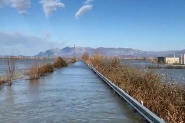
After the intense rains of the last few days, the water has started to recede from the flooded areas in the Shkodër District.
In a report made public recently, the Municipality of Shkodra announces that the total flooded area in this district is 1130 hectares – from 1365 hectares that was yesterday at 4:00 p.m.
In the Ana e Mali Administrative Unit, the situation is presented:
1. The surface of flooded agricultural land is estimated at 700 Ha (from 850 Ha that was yesterday), mainly in the villages of Obot, Muriqan, Oblikë.
2. The Oboti road has 25 cm of water and is passable only with army vehicles.
3. The Oblika 1 and 2 water supply system is out of order as a result of the floods.
Dajç Administrative Unit:
1. The surface of flooded agricultural land is estimated at 100 Ha (from 110 Ha that was yesterday), mainly in the villages of Mushan, Shirq, Pentar. The water level trend in this administrative unit is decreasing.
Administrative Unit Velipoja:
The area of flooded agricultural land is estimated at 100 Ha (from 125 Ha that was on November 23 at 16:00), mainly the villages of Baks, Luarz. Chas.
Guri Zi Administrative Unit:
The area of flooded agricultural land is estimated at 30 Ha (from 80 Ha that was on 23.11.2022 at 16:00), mainly in the villages of Kuç and Rrenc. An erosion of agricultural lands is observed on the bank of the Drin river in the place called Mali i Vukatan, in a length of 800 ml.
Bërdica Administrative Unit:
The surface of flooded agricultural land is estimated at 200 Ha, specifically in Trush villages.
Meanwhile, 7 evacuated families with 24 people are currently receiving service in dormitories.
The hydrometer of Lake Shkodra at 08.00 marks the quota of 8.09 m, (from 8.0 m which was yesterday at 16.00) (Max quota 8.70 m).
The hydrometer of the Drin river at 08:00, marks the quota of 6.05 m, (from 5.70 m which was yesterday at 16:00) (Max quota 7.50 m).
/a.p/
Të ngjashme



Latest News




Most read







 RTI