
 English
 Français
 Deutsch
 Italiano
 Turkish
 Greek
 Serbian
From 15th-Century Shores to Modern Archives: Boka Kotorska’s Cartographic History Unveiled




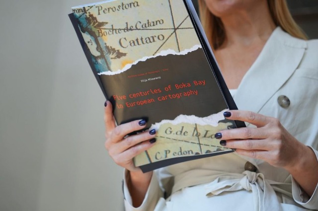
At the Sotir Kolea Center, an exhibition showcased cartographic depictions of Boka Kotorska, spanning from the late 15th century to the early 20th century.
The exhibition invited attendees on a journey through historical and cartographic maps depicting the Bay of Kotor and its surrounding areas. The collection featured cartographic materials from the Maritime Museum in Kotor, along with digitalized resources from national archives and libraries across Europe and the United States.
A total of 185 digitalized maps were displayed, sourced from the Maritime Museum in Kotor and various European and American national archives and libraries. These included geographic, maritime, topographic, military, historical, political, ethnographic maps, among many others. The exhibition offered a unique opportunity to explore the rich cultural and historical heritage of this remarkable region.
/a.c/
Të ngjashme



Latest News







Most read









 RTI